


You may also like
-
The New Yorker 2 Poster
Roger Duvoisin · 1935 · Whimsical tropical islands poster with playful shoreline details and bright mid-century color blocks
Poster from €9 · Framed from €16
Regular price From €6,00Regular price -
Lufthansa World Map Poster
Unknown artist · 1969 · Retro Lufthansa world map poster featuring airplanes, ships, and playful travel motifs
Poster from €9 · Framed from €16
Regular price From €6,00Regular price -
Petit Mentor Poster
Lucien Boucher · 1931 · Playful Art Deco map poster balancing crisp labels with lively illustrated details
Poster from €9 · Framed from €16
Regular price From €6,00Regular price -
British Overseas Airways Poster
Seymour E.O. · 1949 · Colorful BOAC world routes poster with sweeping lines across a stylized globe
Poster from €9 · Framed from €16
Regular price From €6,00Regular price


-

"Very nice Posters. The quality is amazing and we received it very quickly !"
-

"A shop to visit absolutely. Huge selection of posters. We spent more than an hour there !"
-

"Perfect to find gift. Price are very good. An they can frame and pack it on site"


About the Artist
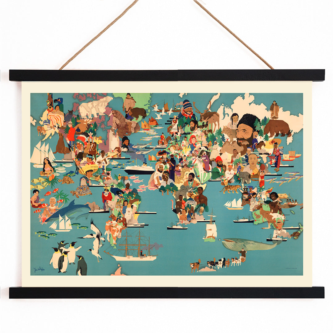
Created by an anonymous artist, this 2015 Population Map reflects the modern resurgence of illustrated wall maps as both informative and decorative pieces. In contemporary map publishing, collaborative design often takes precedence over individual authorship, resulting in works that emphasize clarity, accessibility, and visual charm.
This map is part of a tradition of editorial cartography that aims to engage viewers beyond pure geography, serving as both an educational resource and a lively addition to the home or office. It fits naturally within our map wall art collection, appealing to those who appreciate geography presented with creativity and warmth.
The Artwork
Population Map reimagines global demographics through illustration, transforming statistical data into a visually engaging narrative. Emerging in the 2010s, such maps became popular as educational decor and conversation starters, offering a more approachable alternative to technical infographics.
The artwork not only highlights where people live but also incorporates cultural symbols, wildlife, and regional references, reflecting how different areas are perceived and celebrated. During a period of heightened discussion around migration and population, this kind of map encouraged curiosity and empathy, inviting viewers to explore the world in a more personal way.
Style & Characteristics
The design features a classic world map layout, enlivened with small illustrated scenes reminiscent of travel posters and mid-century editorial graphics. The oceans are rendered in deep blue, while continents are filled with greens and browns, accented by touches of red and yellow on a warm beige background.
Clear outlines and simplified shapes ensure legibility from a distance, while intricate details reward closer inspection. The mood is upbeat and inquisitive, balancing the authority of a reference map with the friendliness of narrative illustration, making it a natural companion to our animal themed prints and blue tone wall art.
In Interior Design
This population map poster brings both structure and warmth to spaces such as home offices, hallways, or living rooms, encouraging guests to pause and explore. Its blend of order and playfulness suits modern, Scandinavian, and eclectic interiors alike.
Pair the beige background with natural wood or linen, and echo the blue tones with ceramics or textiles. It also fits well in a teen's room or learning area, offering educational value without a classroom feel, especially when complemented by a simple frame from our frames collection.